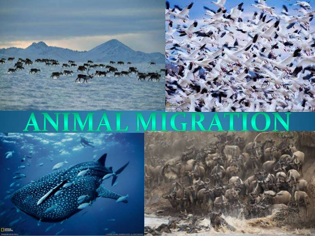
Future Migrations as Earth Warms ( Animated Map, part 1)
Ecosystems, where will animals move to survive? As climate change alters habitats and disrupts and will human development prevent them from getting there. The natural world is under siege by climate change. Rising temperatures are pushing plants and animals outside their current range. To keep pace with climate change species will need a path to follow northward or up in elevation, minimally interrupted by human development. Warming temperatures, changing precipitation patterns, and extreme weather and climate events are likely to increase at a rate and magnitude not seen in more than 65 million years, according to a new study published in the journal Science.
Couple that with other human-related ecosystem disruptions, from highways to deforestation to pollution, and some species could find themselves pushed to the top of the mountain or the tip of a continent with no suitable habitat left in which To keep pace with climate change, species will need a path to follow northward or up in elevation, minimally interrupted by human development.
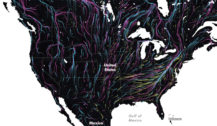
This map shows that path (well, paths actually) in the most beautiful way possible.
It uses the dreamy Earth wind map for inspiration. But rather than using temperature, wind and sea level pressure data, Dan Majka, a web developer at The Nature Conservancy, used data from two studies to show all the feasible paths that mammals, birds and amphibians can use to find their way to a more suitable climate as their habitat becomes too hot.
The map doesn’t show specific species (you’re not going to be able to find the grizzly bear path, for example), but rather shows the general patterns scientists expect animals to follow as the world warms.
The visualization is stunning, but also hopeful. It shows that despite the challenges of climate change and increased urbanization, there are still pathways for the natural world to deal with those threats.
Zoomed out, it’s clear that the Appalachians are a crucial funnel for climate-induced migration. They’re smack dab in one of the most developed parts of the country and represent some of the last wild land in the eastern United States.
“Much of the land outside of the mountain range is developed or in agriculture,” Brad McRae, an ecologist with the Nature Conservancy, said. “So as species ranges shift north, the Appalachians are providing some of the least-developed routes for movement. They also provide some climate relief due to their high elevation.”
Many plants and animals will need to move large distances to track preferred climates, but fragmentation and barriers limit their movements. We asked to what degree and where species will be able to track suitable climates. We demonstrate that only 41% of US natural land area is currently connected enough to allow species to track preferred temperatures as the planet warms over the next 100 years. If corridors allowed movement between all natural areas, species living in 65% of natural area could track their current climates, allowing them to adjust to 2.7 °C more temperature change. The greatest benefits result from connecting low-lying natural areas, especially in the southeastern United States. Facilitating movement will be crucial for preventing biodiversity losses.
University scientists revealed that only 41 percent of the natural land area in the United States retains enough connectivity to facilitate species tracking their preferred climate conditions as the global climate changes. As part of that study, scientists modeled the distribution and habitat needs of 2,903 vertebrate species in the Western hemisphere against land use and projected climate patterns.
Previous work mapped the geographic areas in the western hemisphere through which species will likely need to move to track their suitable climates. That study identified that the Amazon Basin, southeastern United States and southeastern Brazil are three areas with projected high densities of climate-driven movements.
Adapted by Chris Helm, Majka’s dynamic map allows scientists and the public to see the continent-wide impact of climate change on animals and visualize corridors they will need to move. Those high elevation lands will take on added importance and zooming in on the map only reinforces that reality. In South America, there’s a bright swath of yellow moving west out of the Amazon basin to higher elevations. In the Catskills of upstate New York, it’s the same story.
Beyond high elevations, zooming in anywhere on the map gives a glimpse into not just the geography of where and how species will move to beat the heat, but where humans live, work and grow things. New York may be the most populous city in the United States, but it’s a veritable ghost town when it comes to animal migrations spurred by rising temperatures…
To be continued
THAT IS WHY the PleeatPak was created………to protect the ENVIRRONMENT ! BURGER’S LOVERS!!!! PS : INFO@GREENDUSTRIES.COM
Visitors: 5834